
Search
Search Results
Image
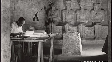
Surveying Abu Simbel's Great Temple
An expert making a detailed survey in the sanctuary of the Great Temple. In the background —from left to right— the seated statues of Ptah, Amun, Rameses II and Harakhte.
Abu Simbel, Nubia, Egypt (March 1960)
Article
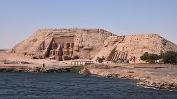
Sailing on Lake Nasser towards Abu Simbel
In ancient times, the First Cataract at Aswan marked the southern frontier of Egypt. Beyond lay the land of Nubia, which stretched along the river Nile from the First Cataract southwards for about 250 kilometres (155 mi). This region, known...
Image
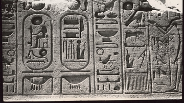
Hieroglyphics Detail, Abu Simbel
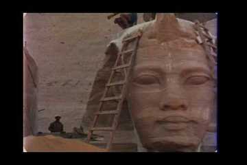
Great Temple (height: 110 feet / 33 meters, width: 127 feet / 38 meters) built under the XIXth Dynasty. On the facade four colossuses about 67 feet / 20 meters high represent Rameses II (1290-1223 BCE). The complete work is about 210 feet...
Image
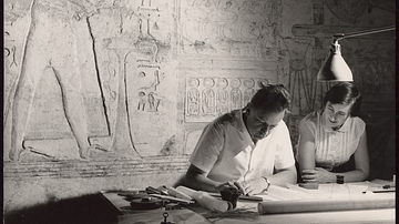
Architectural Survey of Abu Simbel
Geneva architect Jean Jacquet, a UNESCO expert, makes an architectural survey of the Great Temple of Rameses II (1290-1223 BCE). It is hoped that the temple will be preserved in its entirety .
Video
UNESCO Archives Film Collection - The World Saves Abu Simbel (1972)
Digitized by the UNESCO Archives. A production of UNESCO and the Abu Simbel Joint Venture. When the work began on the High Aswan Dam in Upper Egypt, the two temples of Abu Simbel, carved in the living rock which rises from the banks of...
Video
Abu Mena (UNESCO/NHK)
The church, baptistry, basilicas, public buildings, streets, monasteries, houses and workshops in this early Christian holy city in Egypt were built over the tomb of the martyr Menas of Alexandria, who died in A.D. 296. Source: UNESCO...
Image
Map of Ancient Egypt
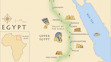
Map of ancient Egypt, showing the major cities and archaeological sites along the Nile River, from Abu Simbel in the south to Alexandria in the north .
Image
Khalid ibn al-Walid's Campaign in Arabia
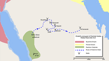
Map detailing the route of the conquest of central Arabia by Khalid ibn al-Walid (585 - 642 CE) during the Ridda Wars, culminating in the decisive battle of Yamama (633 CE). Battles are shown as crossed swords (or scimitars) and the Rashidun...
Image
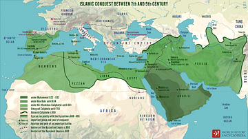
Islamic Conquests in the 7th-9th Centuries
A map illustrating the rise and expansion of early Islamic caliphates from the Prophet Muhammad until the 9th century.
Video
Ramesses the Great, his Long Life and Rule of Ancient Egypt
Ramesses the Great (also known as Ramesses II, as well as the shorter form of his name Ramses) was the third Pharaoh of the Nineteenth Dynasty of Egypt, and not only lived for 96 years but reigned for sixty-six of those years between 1279...