
Search
Search Results
Definition
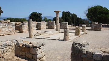
Empuries
Empuries (also Emporiae or Emporion) was a Greek and then Roman colony on the northeastern coast of Spain. Thriving as a local and Mediterranean trading centre, it prospered from the 6th century BCE to the 2nd century CE. Several times the...
Article
Colchis & Iberia in Antiquity
Colchis (western Georgia) and Kartli/Iberia (eastern and southern Georgia) were important regions in the Caucasus area of Eurasia from the Bronze Age of the 15th century BCE. Prospering through agriculture and trade, the region attracted...
Image
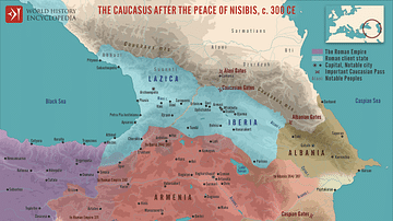
The Caucasus after the Peace of Nisibis, c. 300 CE
A map illustrating the Caucasian states after the First Peace of Nisibis in 299 CE depicts a period of geopolitical stability and well-defined borders between the Roman and Sassanid Empires. This treaty, aimed at settling disputes and establishing...
Image
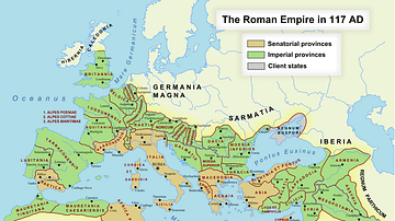
Roman Empire in 117 CE
Map of the Roman Empire at its maximum extent in 117 CE, under the rule of Trajan.
Image
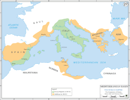
Map of 2nd Century Roman Expansion
A map showing the early expansions of Rome, in the 2nd century BC.
Image
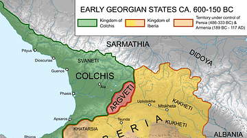
Map of Ancient Georgian States (600-150 BCE)
Map showing the ancient states in the western Caucasus (modern-day Georgia) from c. 600 BCE to 150 BCE.
Image
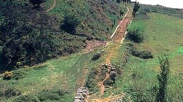
Roman Road, Spain
A section of surviving Roman road near Cirauqui in northern Spain. The curb stones can be clearly seen, a common feature of Roman roads.
Image
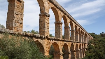
Pont del Diable Aqueduct, Tarraco
The Pont del Diable aqueduct, Tarraco (Tarragona), Spain. Also known as the Ferreres Bridge, it was built in the 1st century CE it is 217 m long and 27 m high.
Image
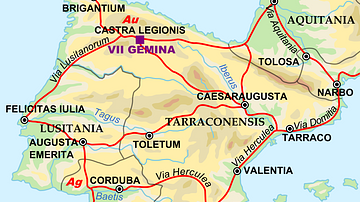
Map of the Iberian Penninsula in 125 AD
A map showing Iberian peninsula in 125 AD including important roads, locations of legions and gold (Au) and silver (Ag) mines.
Image
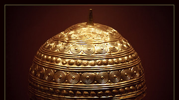
Bronze Age Helmet
Bronze Age golden helmet found in Leiro, Galicia (modern-day Spain). Museo de San Antón, A Coruña.