
Illustration
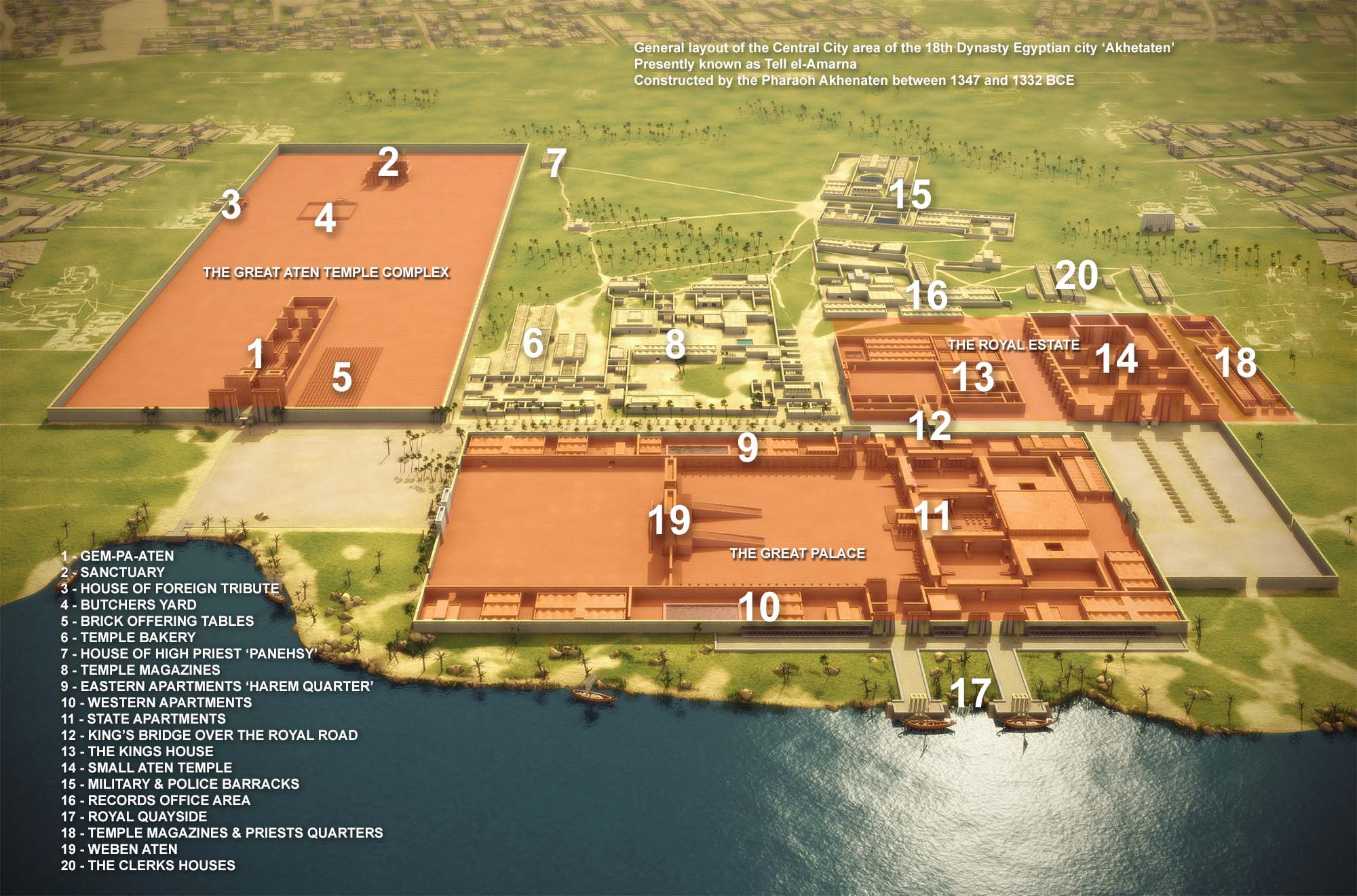
Map showing the general layout of the central city area of the 18th Dynasty Egyptian city "Akhetaten", presently known as Tell el-Amarna, constructed by the Pharaoh Akhenaten between 1347 and 1332 BCE.
Copyright, republished with permission from the author.
Related Images
Image
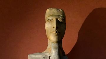
Statue of Akhenaten
This fragmentary statue of the pharaoh Akhenaten (Amenhotep IV...
Image
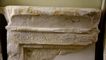
Stela of Akhenaten
This is the upper part of a limestone stela (with a cavetto cornice...
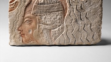
Image
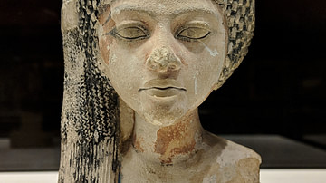
Princess in Akhenaten's Court
Head of a princess in the court of Akhenaten, found in Armarna...
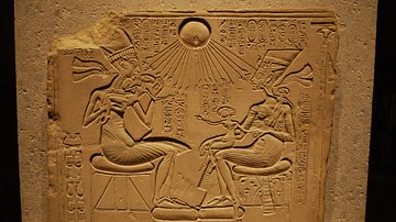
Image
Akhenaten and the Royal Family Blessed by Aten
Limestone relief from Tell el-Amarna, c. 1350 BCE, New Kingdom...
Image
Relief Depicting the Purification of Queen Kiya (?)
This fragment depicting a royal woman undergoing a purification...
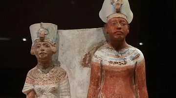
Image
Akhenaten & Nefertiti
This small, painted votive statue depicts the Pharaoh Akhenaten...
Cite This Work
APA Style
Project, P. /. A. (2020, May 19). Map of Amarna, Egypt. World History Encyclopedia. Retrieved from https://www.worldhistory.org/image/12167/map-of-amarna-egypt/
Chicago Style
Project, P.S.Docherty / Amarna3D. "Map of Amarna, Egypt." World History Encyclopedia. Last modified May 19, 2020. https://www.worldhistory.org/image/12167/map-of-amarna-egypt/.
MLA Style
Project, P.S.Docherty / Amarna3D. "Map of Amarna, Egypt." World History Encyclopedia. World History Encyclopedia, 19 May 2020. Web. 19 Apr 2024.