
Illustration

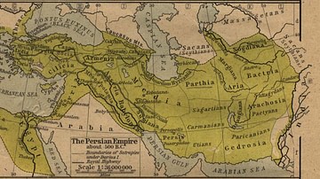
Map of the Persian Achaemenid Empire at its greatest extent under the reigns of Darius the Great and Xerxes.
Inspired by Historical Atlas of Georges Duby (p.11, map D), this map was made by Fabienkhan the 24th of August 2006, using Inkscape and GIMP. Arad translated the map to help.
License & Copyright
 Based on Wikipedia content that has been reviewed, edited, and republished.
Original image by Fabienkhan. Uploaded by Jan van der Crabben, published on 26 April 2012. The copyright holder has published this content under the following license: Creative Commons Attribution-ShareAlike. This license lets others remix, tweak, and build upon a work even for commercial reasons, as long as they credit the author and license their new creations under the identical terms. When republishing on the web a hyperlink back to the original content source URL must be included. Please note that content linked from this page may have different licensing terms.
Based on Wikipedia content that has been reviewed, edited, and republished.
Original image by Fabienkhan. Uploaded by Jan van der Crabben, published on 26 April 2012. The copyright holder has published this content under the following license: Creative Commons Attribution-ShareAlike. This license lets others remix, tweak, and build upon a work even for commercial reasons, as long as they credit the author and license their new creations under the identical terms. When republishing on the web a hyperlink back to the original content source URL must be included. Please note that content linked from this page may have different licensing terms.
Related Images
The Persian Empire
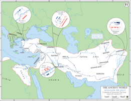
Map of Alexander the Great's Conquests
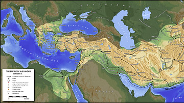
The Empire of Alexander the Great
Silver Orontid Rhyton
Chinese Dynasties Visual Timeline
Map of the Greco-Bactrian Kingdom
References
World History Encyclopedia is an Amazon Associate and earns a commission on qualifying book purchases.Cite This Work
APA Style
Fabienkhan, . (2012, April 26). Achaemenid Empire Map. World History Encyclopedia. Retrieved from https://www.worldhistory.org/image/148/achaemenid-empire-map/
Chicago Style
Fabienkhan, . "Achaemenid Empire Map." World History Encyclopedia. Last modified April 26, 2012. https://www.worldhistory.org/image/148/achaemenid-empire-map/.
MLA Style
Fabienkhan, . "Achaemenid Empire Map." World History Encyclopedia. World History Encyclopedia, 26 Apr 2012. Web. 19 Apr 2024.