
Illustration
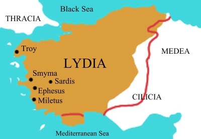
Map of Lydia in the middle of the 6th century BCE. The red line shows an alternative interpretation of Lydia's ancient borders.
License & Copyright
 Based on Wikipedia content that has been reviewed, edited, and republished.
Original image by Roke. Uploaded by Jan van der Crabben, published on 26 April 2012. The copyright holder has published this content under the following license: Creative Commons Attribution-ShareAlike. This license lets others remix, tweak, and build upon a work even for commercial reasons, as long as they credit the author and license their new creations under the identical terms. When republishing on the web a hyperlink back to the original content source URL must be included. Please note that content linked from this page may have different licensing terms.
Based on Wikipedia content that has been reviewed, edited, and republished.
Original image by Roke. Uploaded by Jan van der Crabben, published on 26 April 2012. The copyright holder has published this content under the following license: Creative Commons Attribution-ShareAlike. This license lets others remix, tweak, and build upon a work even for commercial reasons, as long as they credit the author and license their new creations under the identical terms. When republishing on the web a hyperlink back to the original content source URL must be included. Please note that content linked from this page may have different licensing terms.
Related Images
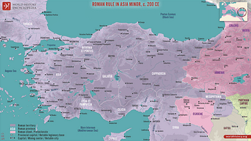
Roman Rule in Asia Minor, c. 200 CE
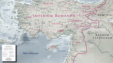
Asia Minor in the Early 1st Century CE

Red-Figure Depiction of Croesus
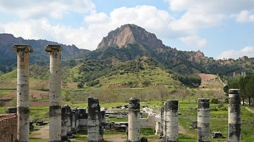
Temple of Artemis, Sardis
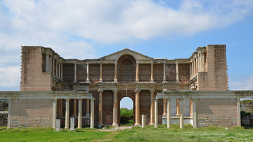
The Bath-Gymnasium Complex at Sardis

Defeat of Croesus at Thymbra
Cite This Work
APA Style
Roke, . (2012, April 26). Map of Lydia. World History Encyclopedia. Retrieved from https://www.worldhistory.org/image/155/map-of-lydia/
Chicago Style
Roke, . "Map of Lydia." World History Encyclopedia. Last modified April 26, 2012. https://www.worldhistory.org/image/155/map-of-lydia/.
MLA Style
Roke, . "Map of Lydia." World History Encyclopedia. World History Encyclopedia, 26 Apr 2012. Web. 16 Apr 2024.