
Illustration
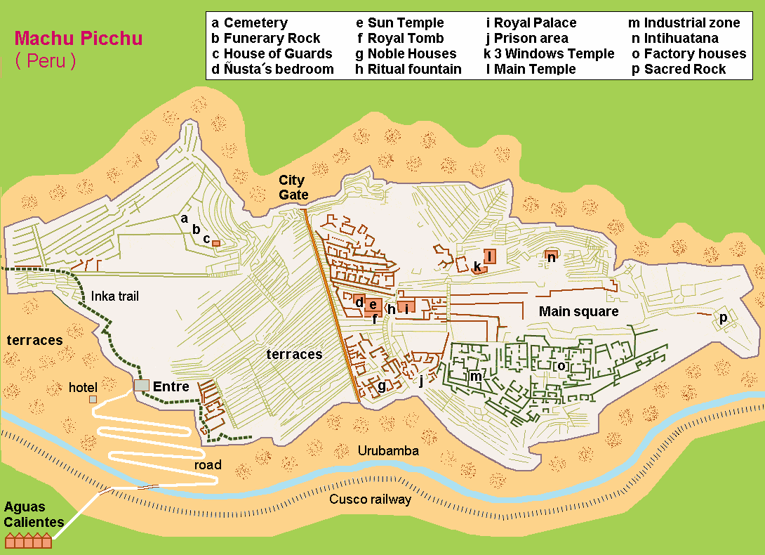
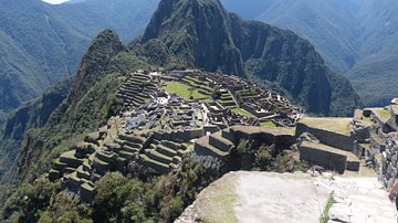
A map of Machu Picchu, the Inca site in the high Andes in the Urubamba Valley. The settlement was founded by Pachacuti Inca Yupanqui in c. 1450 CE. Typical of Inca architecture, the settlement follows the contours of the natural topography.
License & Copyright
 Based on Wikipedia content that has been reviewed, edited, and republished.
Original image by Hobe / Holger Behr. Uploaded by Mark Cartwright, published on 03 March 2014. The copyright holder has published this content under the following license: Public Domain. This item is in the public domain, and can be used, copied, and modified without any restrictions. Please note that content linked from this page may have different licensing terms.
Based on Wikipedia content that has been reviewed, edited, and republished.
Original image by Hobe / Holger Behr. Uploaded by Mark Cartwright, published on 03 March 2014. The copyright holder has published this content under the following license: Public Domain. This item is in the public domain, and can be used, copied, and modified without any restrictions. Please note that content linked from this page may have different licensing terms.
Related Images
Machu Picchu Aerial View
Kallanka, Machu Picchu
Intihuatana Stone, Machu Picchu
Machu Picchu Panorama
Torreon, Machu Picchu
Machu Picchu, Peru
Cite This Work
APA Style
Behr, H. /. H. (2014, March 03). Map of Machu Picchu. World History Encyclopedia. Retrieved from https://www.worldhistory.org/image/2339/map-of-machu-picchu/
Chicago Style
Behr, Hobe / Holger. "Map of Machu Picchu." World History Encyclopedia. Last modified March 03, 2014. https://www.worldhistory.org/image/2339/map-of-machu-picchu/.
MLA Style
Behr, Hobe / Holger. "Map of Machu Picchu." World History Encyclopedia. World History Encyclopedia, 03 Mar 2014. Web. 19 Apr 2024.