
Illustration
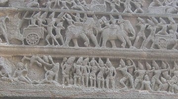
A map of the caves and temples at Ellora, in Maharastra, central India. The structures are Hindu, Buddhist, and Jain. 6th-8th century CE.
License & Copyright
 Based on Wikipedia content that has been reviewed, edited, and republished.
Original image by Gatis Pavils. Uploaded by Mark Cartwright, published on 08 March 2016. The copyright holder has published this content under the following license: Creative Commons Attribution-NonCommercial-ShareAlike. This license lets others remix, tweak, and build upon this content non-commercially, as long as they credit the author and license their new creations under the identical terms. When republishing on the web a hyperlink back to the original content source URL must be included. Please note that content linked from this page may have different licensing terms.
Based on Wikipedia content that has been reviewed, edited, and republished.
Original image by Gatis Pavils. Uploaded by Mark Cartwright, published on 08 March 2016. The copyright holder has published this content under the following license: Creative Commons Attribution-NonCommercial-ShareAlike. This license lets others remix, tweak, and build upon this content non-commercially, as long as they credit the author and license their new creations under the identical terms. When republishing on the web a hyperlink back to the original content source URL must be included. Please note that content linked from this page may have different licensing terms.
Related Images
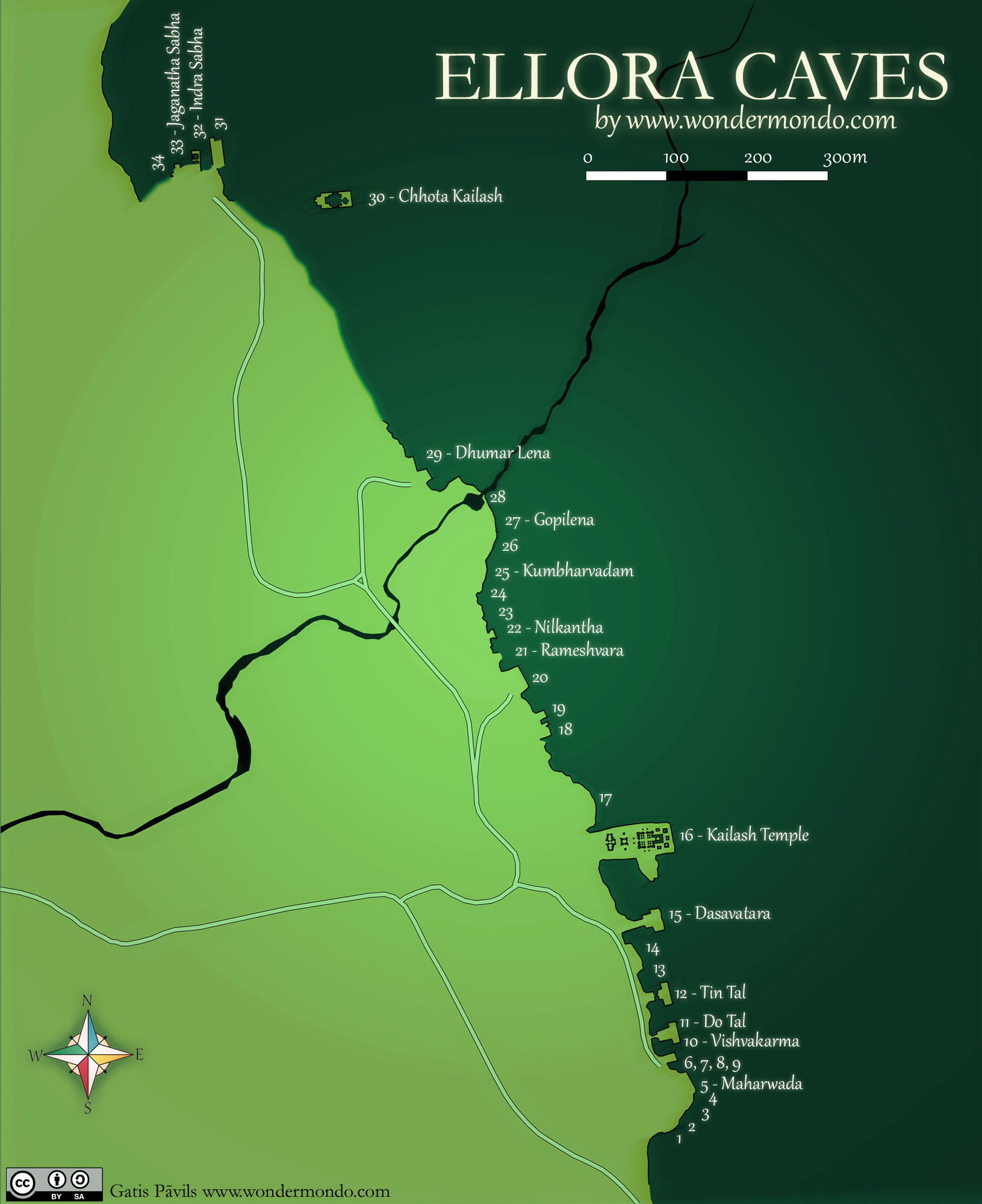
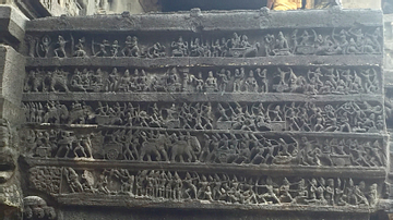
War Elephants of the Rashtrakutas, Ellora Caves
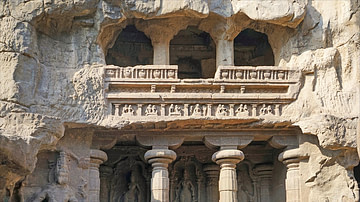
Kailasa Temple, Ellora
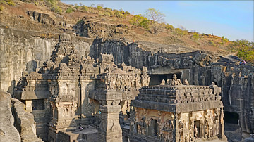
The Armies of the Rashtrakutas (Eighth to Tenth Centuries CE)
Shrine of the Kailasa Temple, Ellora
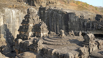
Roof of Kailasa Temple, Ellora
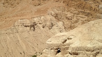
Qumram Caves
Cite This Work
APA Style
Pavils, G. (2016, March 08). Ellora Caves Map. World History Encyclopedia. Retrieved from https://www.worldhistory.org/image/4607/ellora-caves-map/
Chicago Style
Pavils, Gatis. "Ellora Caves Map." World History Encyclopedia. Last modified March 08, 2016. https://www.worldhistory.org/image/4607/ellora-caves-map/.
MLA Style
Pavils, Gatis. "Ellora Caves Map." World History Encyclopedia. World History Encyclopedia, 08 Mar 2016. Web. 18 Apr 2024.