
Illustration
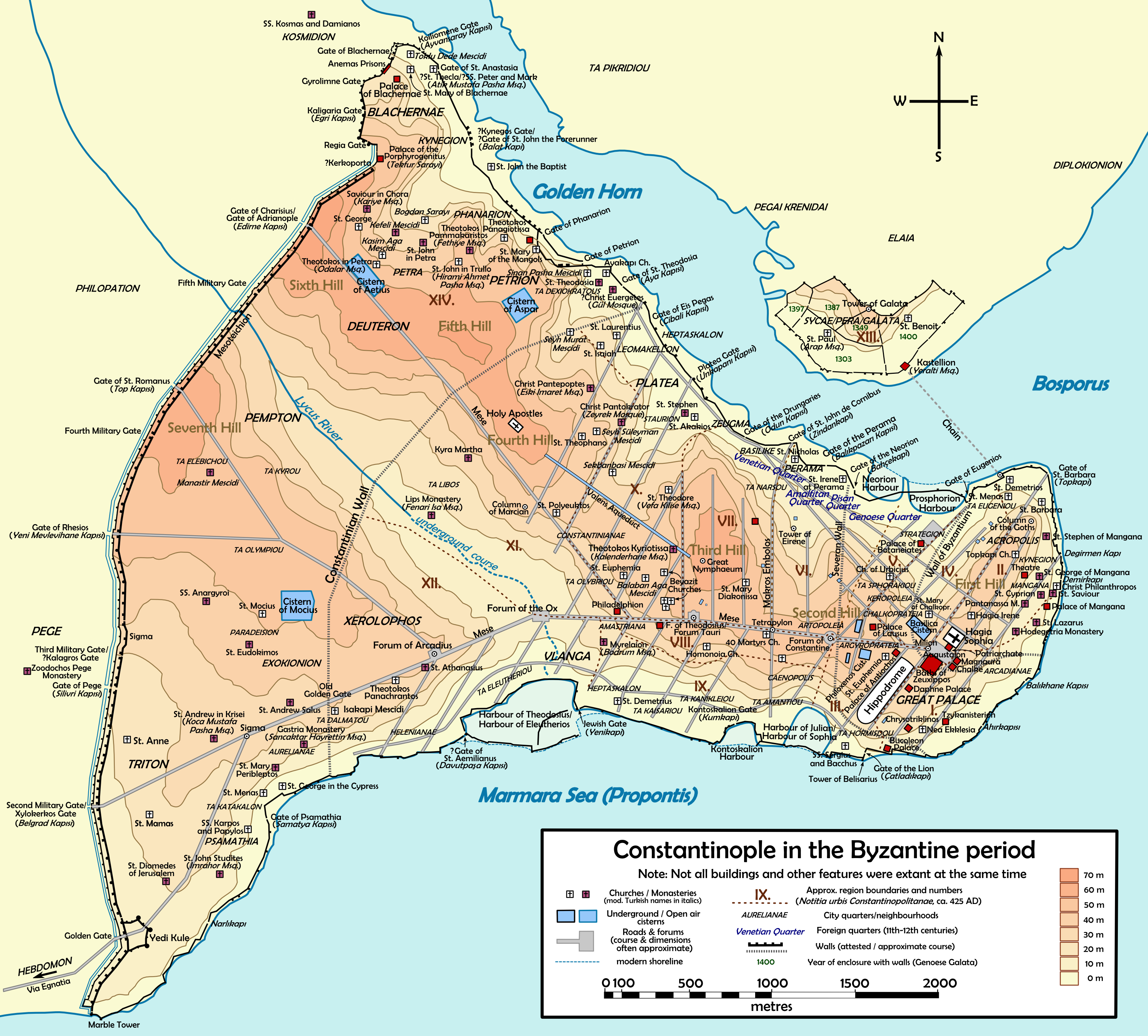
Topographical map of Constantinople during the Byzantine period. Main map source: R. Janin, Constantinople Byzantine. Developpement urbain et repertoire topographique. Road network and some other details based on Dumbarton Oaks Papers 54; data on many churches, especially unidentified ones, taken from the University of New York's The Byzantine Churches of Istanbul project. Other published maps and accounts of the city have been used for corroboration.
License & Copyright
 Based on Wikipedia content that has been reviewed, edited, and republished.
Original image by Cplakidas. Uploaded by Jan van der Crabben, published on 21 December 2011. The copyright holder has published this content under the following license: Creative Commons Attribution-ShareAlike. This license lets others remix, tweak, and build upon a work even for commercial reasons, as long as they credit the author and license their new creations under the identical terms. When republishing on the web a hyperlink back to the original content source URL must be included. Please note that content linked from this page may have different licensing terms.
Based on Wikipedia content that has been reviewed, edited, and republished.
Original image by Cplakidas. Uploaded by Jan van der Crabben, published on 21 December 2011. The copyright holder has published this content under the following license: Creative Commons Attribution-ShareAlike. This license lets others remix, tweak, and build upon a work even for commercial reasons, as long as they credit the author and license their new creations under the identical terms. When republishing on the web a hyperlink back to the original content source URL must be included. Please note that content linked from this page may have different licensing terms.
Related Images
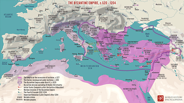
The Byzantine Empire, c.520 - 1204

Byzantine Jeweled Bracelet
Bulgarian Empire under Tsar Samuil, 997 - 1014
Bulgarian Empire under Khan Krum the Fearsome, 803-814

Byzantine Child's Tunic with Hood

Byzantine Empress Zoe
Cite This Work
APA Style
Cplakidas, . (2011, December 21). Map of Byzantine Constantinople. World History Encyclopedia. Retrieved from https://www.worldhistory.org/image/564/map-of-byzantine-constantinople/
Chicago Style
Cplakidas, . "Map of Byzantine Constantinople." World History Encyclopedia. Last modified December 21, 2011. https://www.worldhistory.org/image/564/map-of-byzantine-constantinople/.
MLA Style
Cplakidas, . "Map of Byzantine Constantinople." World History Encyclopedia. World History Encyclopedia, 21 Dec 2011. Web. 18 Apr 2024.