
Illustration
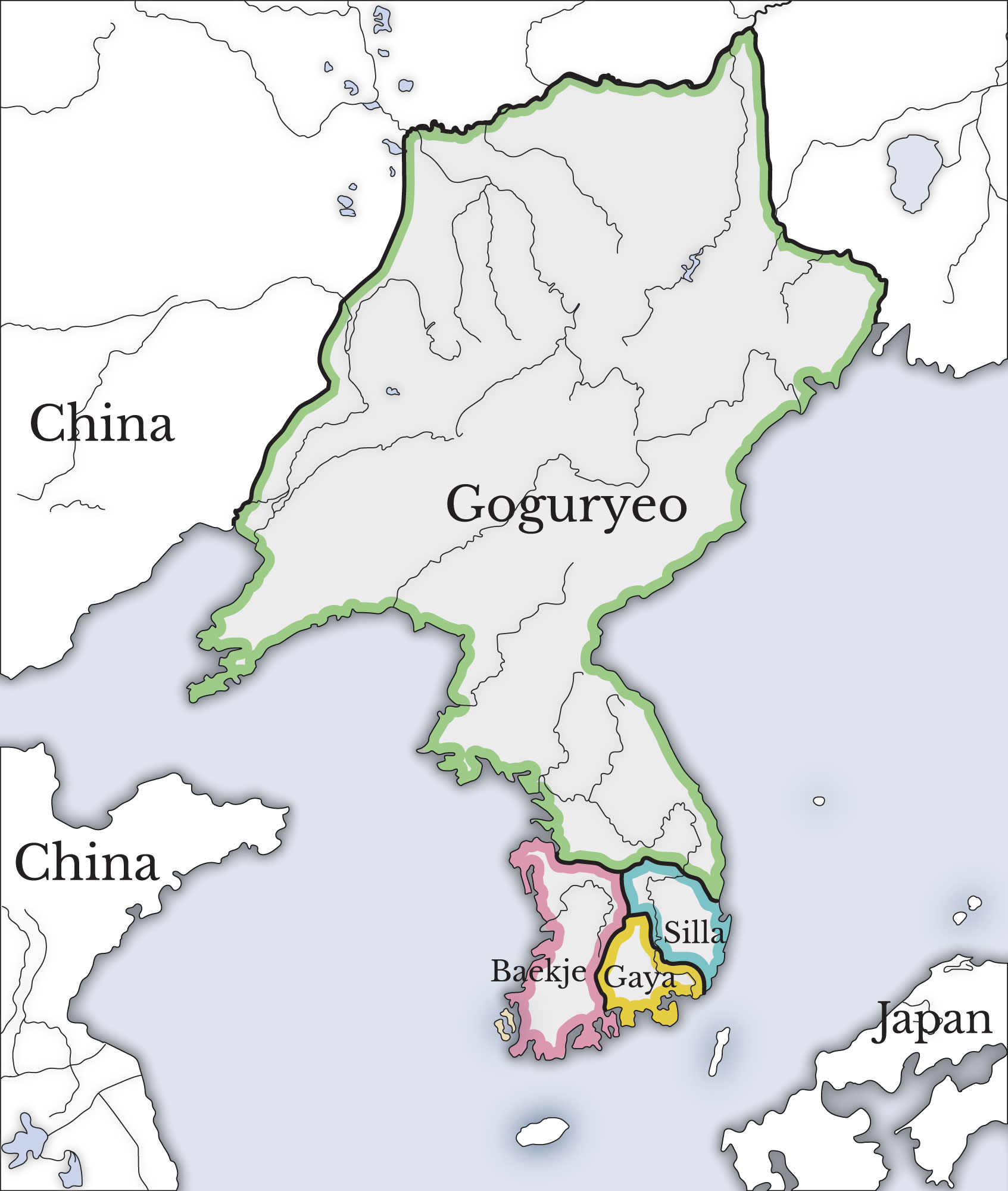
A map showing the three kingdoms (Goguryeo, Silla, and Baekje) and the Gaya confederation which ruled Korea between the 1st and 7th century CE.
Related Images
Image
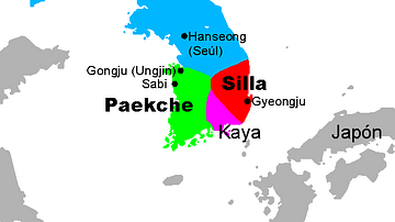
Three Kingdoms, Korea
A map showing the Three kingdoms of ancient Korea (57 BCE - 668...
Image
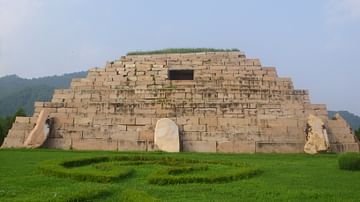
Tomb of Gwanggaeto the Great
The tomb of Goguryeo king Gwanggaeto the Great (r. 391–412 CE...

Image
Gwanggaeto Stele
The Gwanggaeto Stele which describes the key events of the Goguryeo...
Image
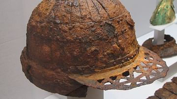
Gaya Iron Helmet
An iron helmet from the Gaya confederacy (42-532 CE), Korea. 5th-6th...
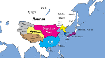
Image
East Asia in 500 CE
This map shows the territories of all major civilizations in East...

Image
Baekje Incense Burner
A gilt-bronze incense burner from the Baekje (Paekche) Kingdom...
References
- http://en.wikipedia.org/wiki/Special:Export/File:History_of_Korea-476.PNGAccessed 19 Mar 2020.
Cite This Work
APA Style
Kamel, A. (2016, September 30). Three Kingdoms of Korea Map. World History Encyclopedia. Retrieved from https://www.worldhistory.org/image/5790/three-kingdoms-of-korea-map/
Chicago Style
Kamel, Ashraf. "Three Kingdoms of Korea Map." World History Encyclopedia. Last modified September 30, 2016. https://www.worldhistory.org/image/5790/three-kingdoms-of-korea-map/.
MLA Style
Kamel, Ashraf. "Three Kingdoms of Korea Map." World History Encyclopedia. World History Encyclopedia, 30 Sep 2016. Web. 18 Apr 2024.