
Illustration
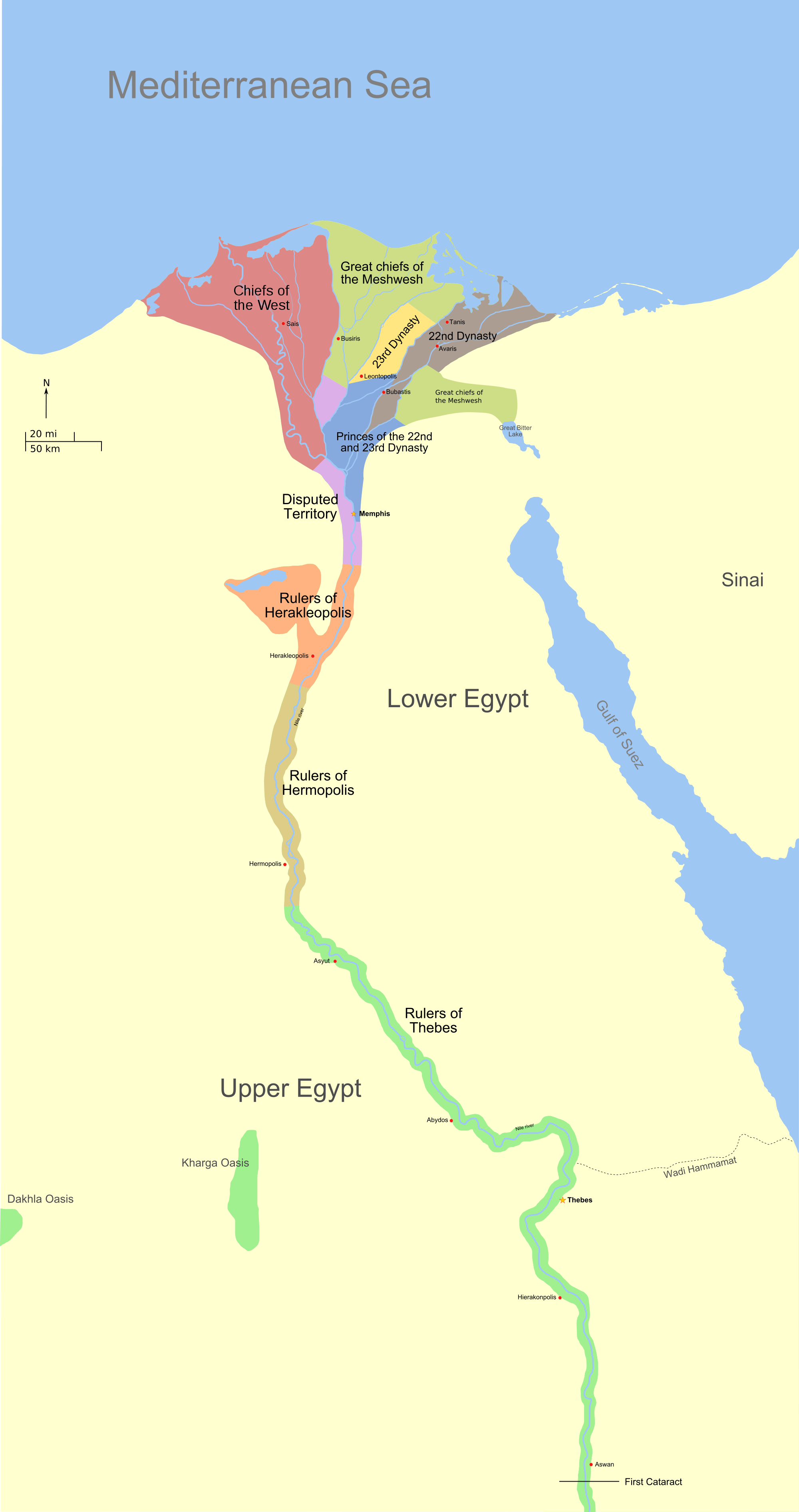
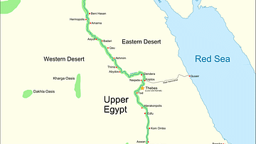
A map showing the political divisions in ancient Egypt during the Third intermediate Period, about 730 BC. The rulers of the 22nd and 23rd Dynasties ruled simultaneously, alongside Libyan chieftains controlling most of the Delta.
License & Copyright
 Based on Wikipedia content that has been reviewed, edited, and republished.
Original image by Jeff Dahl. Uploaded by Jan van der Crabben, published on 26 April 2012. The copyright holder has published this content under the following license: Creative Commons Attribution-ShareAlike. This license lets others remix, tweak, and build upon a work even for commercial reasons, as long as they credit the author and license their new creations under the identical terms. When republishing on the web a hyperlink back to the original content source URL must be included. Please note that content linked from this page may have different licensing terms.
Based on Wikipedia content that has been reviewed, edited, and republished.
Original image by Jeff Dahl. Uploaded by Jan van der Crabben, published on 26 April 2012. The copyright holder has published this content under the following license: Creative Commons Attribution-ShareAlike. This license lets others remix, tweak, and build upon a work even for commercial reasons, as long as they credit the author and license their new creations under the identical terms. When republishing on the web a hyperlink back to the original content source URL must be included. Please note that content linked from this page may have different licensing terms.
Related Images
Timeline of Ancient Egypt
Wadjet & Nekhbet Seated on a Basket
Great Temple, Petra
Ancient Egypt

Lower Innisidgen Burial Chamber
Hunting in the Marshes
Cite This Work
APA Style
Dahl, J. (2012, April 26). Map of the Third Intermediate Period. World History Encyclopedia. Retrieved from https://www.worldhistory.org/image/596/map-of-the-third-intermediate-period/
Chicago Style
Dahl, Jeff. "Map of the Third Intermediate Period." World History Encyclopedia. Last modified April 26, 2012. https://www.worldhistory.org/image/596/map-of-the-third-intermediate-period/.
MLA Style
Dahl, Jeff. "Map of the Third Intermediate Period." World History Encyclopedia. World History Encyclopedia, 26 Apr 2012. Web. 19 Apr 2024.