
Illustration
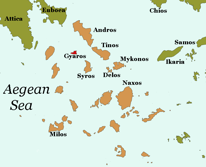
A map of Gyaros, a barren island in the Cyclades. Gyaros' remote, desolate location inspired its use as a place of exile during Antiquity, and has been used for this purpose in more recent history.
About the Author

Arienne King is a student and freelance writer with a passion for history, archaeology, and digital media. She runs the blog Muses & Mayhem and is the Media Editor for Ancient History Encyclopedia.
Related Images
Image
Transatlantic Triangular Trade Map
Map showing the flow of goods and enslaved people across the Atlantic...
Image
Polynesian Migration Map
Map showing the migration of Polynesians who it is thought were...
Image
Battle of Brandywine Map
Map depicting the Battle of Brandywine (11 September 1777...
Image
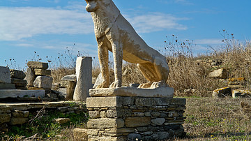
Delos Lion Sculpture
A lion sculpture in marble from the island of Delos in the Greek...
Image
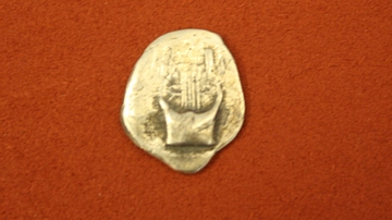
Delos Silver Drachm
Silver drachm from Delos, Cyclades, late 6th century BCE. O: Lyre...
Image
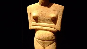
Cycladic Figurine c. 2400 BCE
A marble figurine from the Cycladic islands, c. 2400 BCE. The posture...
Cite This Work
APA Style
King, A. (2019, April 22). Map of Gyaros. World History Encyclopedia. Retrieved from https://www.worldhistory.org/image/10488/map-of-gyaros/
Chicago Style
King, Arienne. "Map of Gyaros." World History Encyclopedia. Last modified April 22, 2019. https://www.worldhistory.org/image/10488/map-of-gyaros/.
MLA Style
King, Arienne. "Map of Gyaros." World History Encyclopedia. World History Encyclopedia, 22 Apr 2019. Web. 25 Apr 2024.